Page 2
Map (.pdf) of Rocky Mountain National Park
.kmz file of Todd's path (for Google Earth)
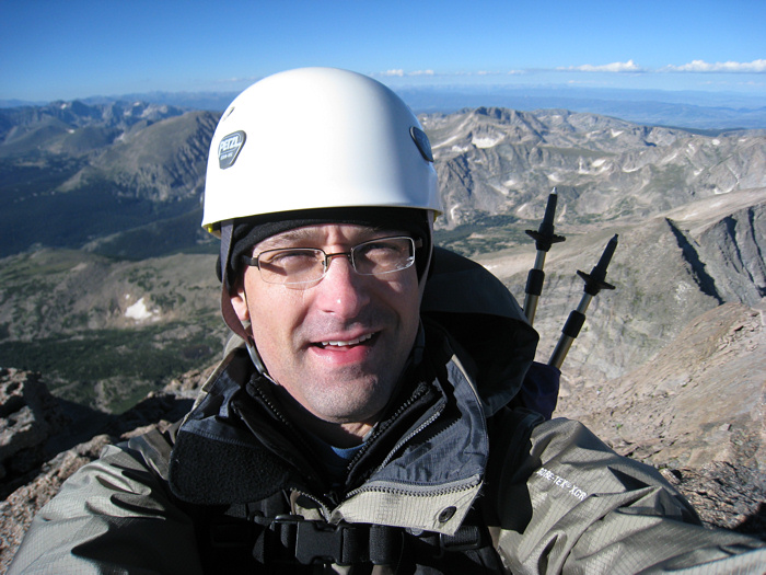
I reached the summit at 8:25am. There were maybe 25 to 40 people on top when I arrived. I think there were only a couple of people that were coming down while I was going up.
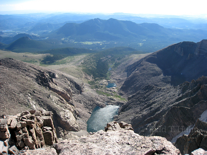
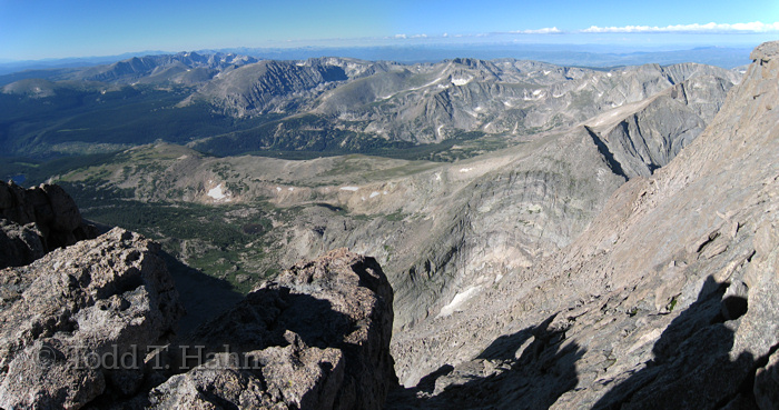
Chasm Lake off the East face of Longs Peak. 8:31am
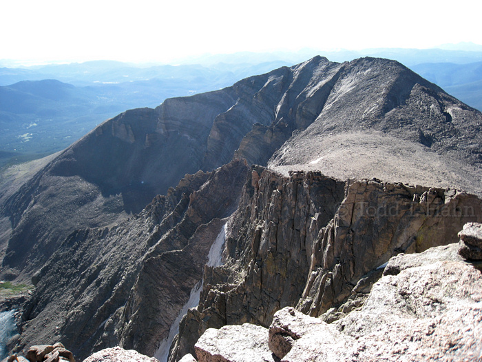
Mount Meeker, Lamb's Slide, and the Loft. 8:31am
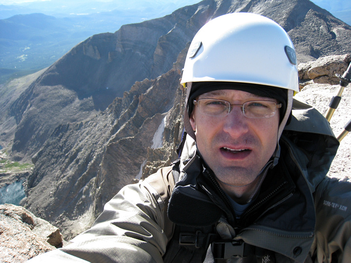
8:33am
8:33am
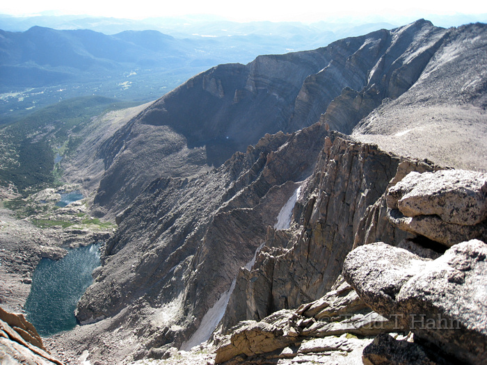
8:34am
8:35am
8:38am
Some video from the summit... Left the summit at 8:55am.
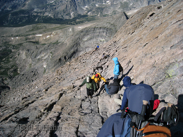
Small traffic jam near the top of the Homestretch -- had to wait about 5 minutes for people to come up past a level where there is only one relatively safe "lane". 9:06am.
The bottom of the Homstretch before a bottleneck where there is a climbing move that requires hands. Those of us going down were waiting for people to come up. 9:16am
9:18am
Video from the Narrows on the way down.
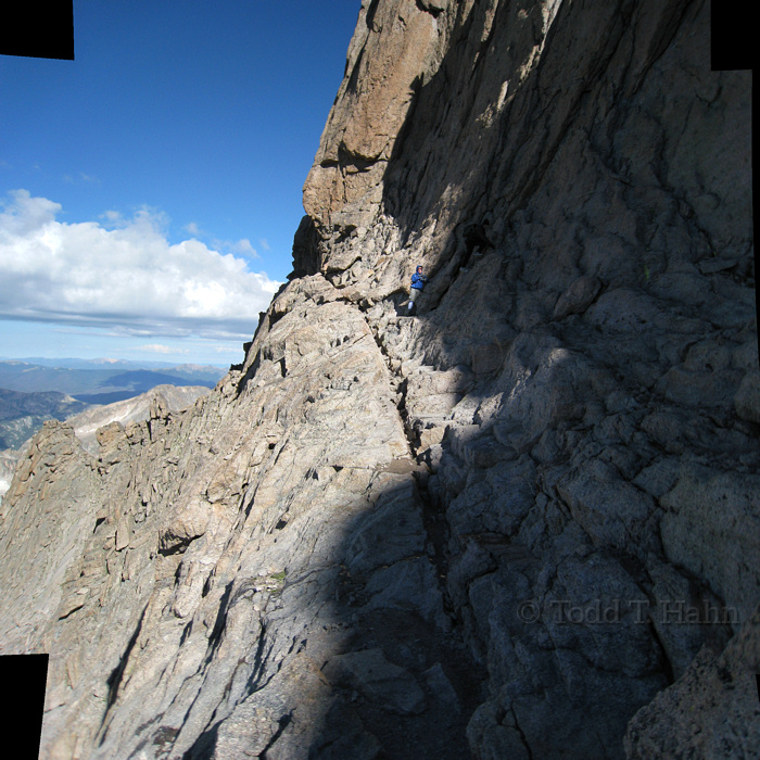
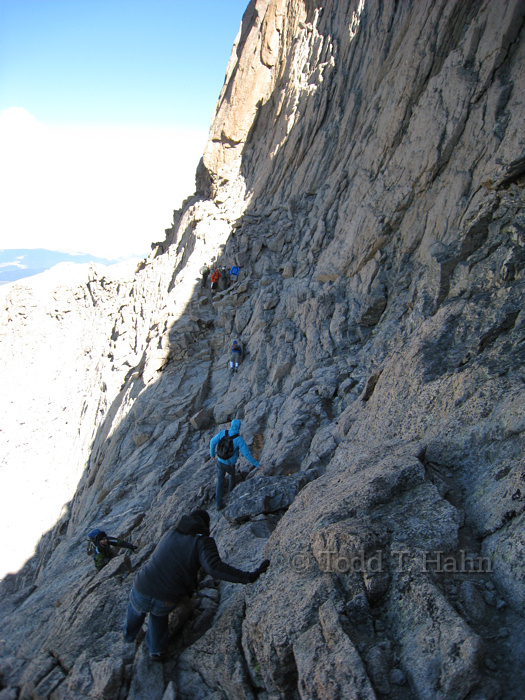
The Narrows on the way back. I have no idea what these guys were doing (Note guy in dark grey climbing up to a more precarious position). He might have been clowning or posing for the other guy's camera. 9:19am
Some video from the Trough on the way down. (9:25am, 9:26am, 9:31am, 9:31am)
Some video from the Ledges on the way down. (10:02am, 10:02am, 10:06am, 10:09am, 10:10am)
10:08am
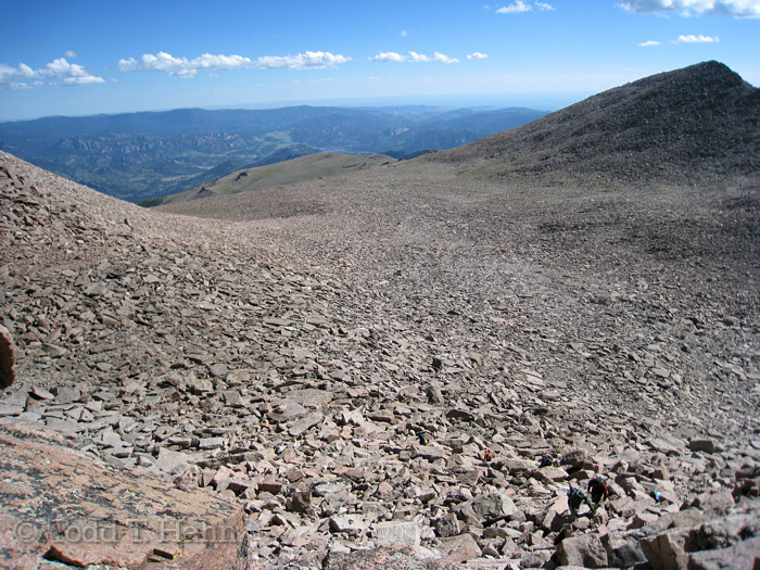
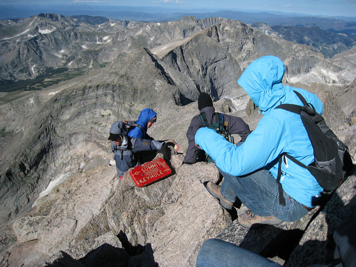
The Boulderfield from the Keyhole. It was difficult for me to cross the Boulderfield on the way back -- my legs were wobbly and I was a bit unsteady from the past few hours at above 12,000 feet. 10:19am
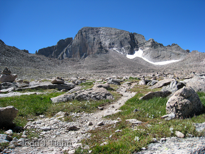
11:18am
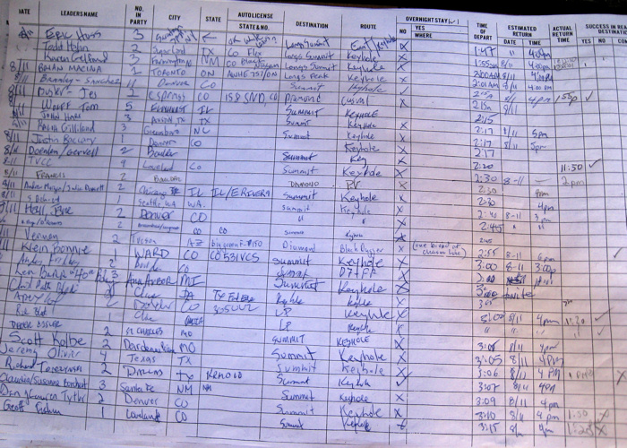
Trail register. Arrived back at the car at 2:01pm for a total of 12 hours and 6 minutes.
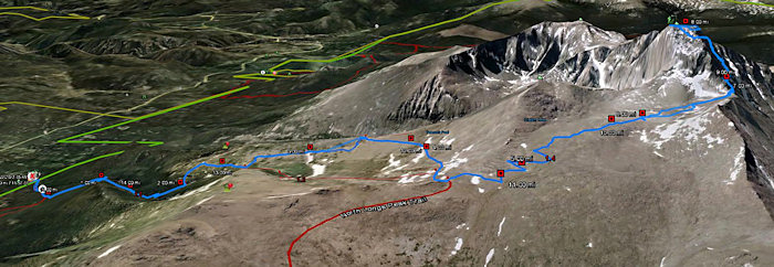
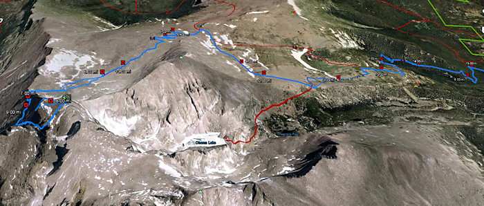
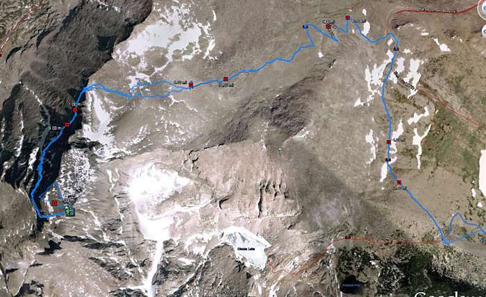
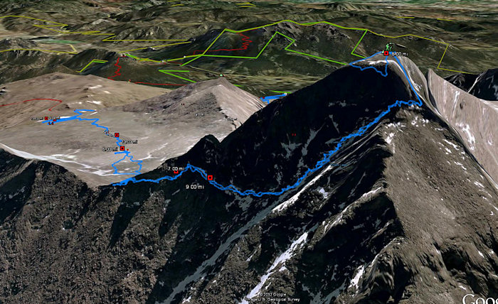
Some Google Earth views of the route:

Advice:
Preface: It always helps to know who is giving you advice and what their experience and fitness level is. I (Todd) am a runner and can run a 5k in around 21-22 minutes and a half marathon in under 1:45. Heather is reasonably fit, but not a runner per se. We both have rock climbed at a top-rope 5.10 level and have taken several backcountry backpacking trips. Prior to this climb, we had previously climbed Mount Adams (12000'+ peak, WA), Ruth Mountain (3000' elev gain, 13 miles, 7000'+ peak, WA), Guadalupe Peak (3000'+ elev gain, 8000'+ peak, TX), Humboldt Peak (5000+ elev gain over two days, 14000'+ peak, CO) and have attempted Wheeler peak (13161', NM) twice during the winter.
- Acclimate for at least three nights at 5000+ feet, preferably with two nights at 7500+. We also did a hike with elevation gain two days before and took it easy the day before (went up to Trail Ridge Road).
- Drink lots of water while acclimating.
- You must train, unless you regularly hike and climb in the mountains, in which case you don't care what I say and are very likely not reading this.
- Don't underestimate the mental portion of this undertaking. I completed the route, but my wife did not. She is a little more sensitive to heights/exposure than I am. If you are sensitive to heights or would feel uncomfortable on a sloping ledge with the wind whipping and 800 feet of nothing next to the ledge, this is not the route for you. Don't put yourself and others in danger by going past the Keyhole.
- There's a huge boulderfield to cross. There are loose rocks and boulders. There are precipitous drop-offs. There are steep places were you have to use your hands and "climb". These places could easily get you injured or killed.
- On a route like this, there is always a level of inherent danger, meaning you could get killed or seriously injured though no fault of your own.
- Of course, if there is any chance of afternoon thunderstorms in the forecast, start really early. Although even if there is no mention of thunderstorms in the forecast, it would be best to assume there could still be some. We started around 2am because we wanted plenty of cushion to be off the highest parts of the mountain by noon.
- There is water along the trail in places (although our experience was in a good snowfall year). So you can may be able to do with bringing only one or two liters per person and using a water filter to replenish along the way. See the topo maps of the area for the stream crossings.
- Wear a helmet. I was probably the only one wearing a alpinist/rock-climbing helmet the day we did Longs Peak. However, when past the Keyhole, rock fall could occur. I have heard of people being narrowly missed by small stones in the Trough. There is a lot of loose rock in the Trough. Be safe and wear a helmet.
- Don't try this route without a lot of physical preparation and some experience on steep, exposed mountains with loose rock.
- Upwards of 50 people have died on this mountain, and people die every single year. One person was blown off the upper parts of the mountain the week before we arrived.